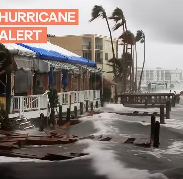
Hurricane Erin, once a powerful Category 5 storm, has weakened to a Category 3 but continues to pose a significant threat across the Atlantic Ocean. According to the National Hurricane Center (NHC), Erin is still producing sustained winds of 125 mph as it tracks northwestward. While current forecasts suggest the storm will not make direct landfall in the continental United States, its vast size means millions along the East Coast could still feel its effects through strong winds, heavy surf, and flooding in the coming days.
Forecasters emphasized that Erin’s danger extends well beyond its eye. Hurricane-force winds stretch outward nearly 50 miles, while tropical-storm-force winds span more than 200 miles from the storm’s center. Torrential rains are already lashing Puerto Rico, the Turks and Caicos, and parts of the Bahamas, with some regions expected to receive up to six inches of rainfall. Officials warn this amount of precipitation could lead to flash flooding and trigger landslides in mountainous terrain.
In response, North Carolina’s Dare County and Hyde County declared states of emergency over the weekend, ordering mandatory evacuations for Hatteras Island and Ocracoke Island. Authorities warned that Highway 12, the main lifeline for residents and visitors, could be overtaken by ocean overwash as waves cresting up to 20 feet pound the shoreline. Officials urged those with medical needs and limited mobility to evacuate immediately while routes remain open and accessible.
Emergency management agencies across the East Coast continue to stress preparedness. Residents are advised to closely monitor official forecasts, review disaster response plans, and stock up on essential supplies such as food, water, medications, and flashlights. While projections keep Hurricane Erin offshore, its immense size ensures widespread impacts — a sobering reminder that even storms that don’t make direct landfall can still bring dangerous, life-altering conditions.